Beschreibung
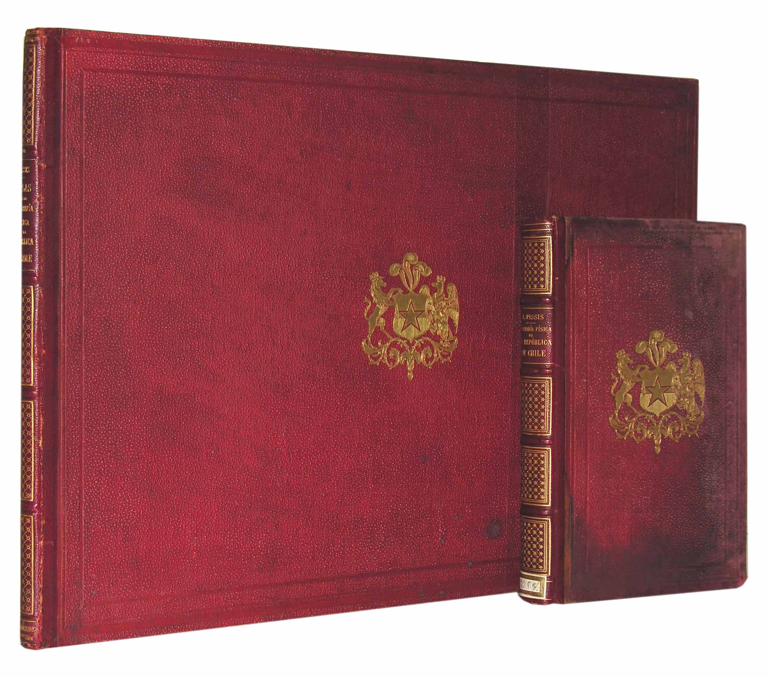
SÜDAMERIKA/CHILE – PISSIS, A. Geografía Física de la República de Chile. Paris, Delagrave, 1875. Text- u. Atlasband in 2 Bdn. 8° u. quer-4°. X S., 1 nn. Bl., 356 S.; 2 nn. Bl., m. 1 lithogr. Karte u. 22 (3 farb.) lithogr. Tafeln. Originale Halblederbände mit goldgeprägten Wappensupralibros und reicher Rückenvergoldung, (leicht beschabt und leicht fleckig, Textband stärker fleckig und berieben).
Erste Ausgabe, komplett mit Text- und Atlasband selten. – Palau 227450; Henze IV, 125 ff. – Hauptwerk des in Frankreich geborenen Kartographen und Geologen Pedro Amado Pissis Marin (1812-1889), welches die Erkenntnisse seiner Reisen durch alle Teile Chiles zwischen 1848 und 1868 vereint. – „Nebst Phillipi hat Pissis gewiß den größten Anteil an der wissenschaftlichen Erschließung Chiles in der zweiten Hälfte des 19. Jahrhunderts.“ (Henze). – Mit einer Karte Südamerikas, Höhenprofilen, einer farbigen Tafel des Aconcaguamassivs, mehreren anderen Bergdarstellungen der Anden, die Quelle des Lontue, den Vulkan Chillan, einer farbigen Tafel des Kraters des Vulkans Antuco, Lava des Osorno, einer Darstellung eines Gletschers usw. – Der Textband geht ausführlich auf die Orthographie, Geologie, Meteorologie, Hydrographie und botanische Geographie Chiles ein. – Textband an der oberen und unteren Ecke etw. wasserfl., Name v. alter Hand auf Titel, Tafelband m. altem Bibliotheksstempel a. Titel, minimal stockfl. // With 1 lithographed map and 22 (3 coloured) lithographed plates. Contemporary half calf with book-stamped coat of arms, spine richly gilt, (slightly scratched, text volume somewhat spotted and rubbed). First edition, complete rare. Palau 227450; Henze IV, 125 ff. Main work of the cartographer and geologist Pedro Amado Pissis Marin (1812-1889). It combines the findings of his travels through all parts of Chile in 1848 and 1868. „Nebst Phillipi hat Pissis gewiß den größten Anteil an der wissenschaftlichen Erschließung Chiles in der zweiten Hälfte des 19. Jahrhunderts.“ (Henze). With a map of South America, profiles of altitude, a coloured plate of the massif of the Aconcagua, more illustrations of Andenous mountains, the spring of river Lontue, the volcano Chillan, and a coloured plate of the volcanic crater of Antuco, lava of the Osorno, an illustration of a glacier, etc. The text explains in detail the orography, geology, meteorology, hydrography and botanical geography of Chile. Textvolume waterstained at margins, name on title, atlas with stamp on title, some minor foxing.
Geographie, Chile, Geographie, Geologie, Südamerika


