


PITT, Moses. The English Atlas.
Vol. II (and III): Containing the description of Empire of Germany.
10.000,00 €
zzgl. Versandkosten
verfügbar
Beschreibung
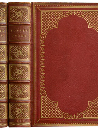
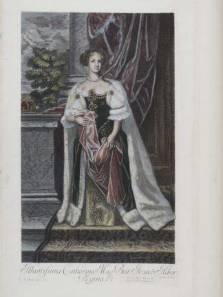
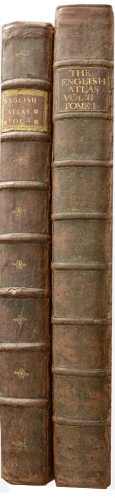
ATLANTEN – PITT, Moses. The English Atlas. Vol. II (and III): Containing the description of Empire of Germany. London, for Moses Pitt, 1681-1683. 2 Bände. Gr.-Fol. Gestochenes koloriertes Portrait, gestochener kolorierter Titel, 2 nn. Bl., 151 S., 40 nn. Bl.; gestochenes koloriertes Portrait, 2 nn. Bl., S. 157-312, 37 nn. Bl., mit 90 (4 gefalteten und 85 doppelblattgroßen) grenzkolorierten Kupferstichkarten. Leder der Zeit mit Rückenschild, (berieben, Gelenke und Kapitale unterlegt).
Erste und einzige Ausgabe. – Koemann II, Me 183. – Die 2 vorliegenden Bände beinhalten den vollständigen Deutschlandteil unter Einschluss der damals zum Hl. Römischen Reich gehörenden Gebiete wie, Böhmen, Österreich, Ungarn und Transylvanien. – Das nach dem 4. Band eingestellte Projekt eines englischsprachigen Atlasses basierte auf der Grundlage des „Atlas Major“ von Janssonius, dessen Karten etwas überarbeitet wurden. Es finden sich jedoch auch einige Karten, die sonst nirgendwo erschienen sind, darunter die schönen Faltkarten von der Wesermündung und Baden. – Eine Karte mit Einriss, im Bug teils etwas knickfaltig, wenige Karten etwas angerändert, die Weserkarte leicht beschnitten, Ex-Libris auf Innendeckel. – Insgesamt innen sehr gutes, breitrandiges, nur minimal fleckiges Exemplar mit kolorierten Kartuschen. // Engraved coloured portrait, engraved coloured title, 2 unn. ll., 151 pp., 40 unn. ll.; engraved coloured portrait, 2 unn. ll., p. 157-312, 37 unn. ll., with 90 (4 folded and 85 double-page) border coloured engraved maps. Contemporary calf with label, (rubbed, hinges and end of spine restored). – First and only edition. Koemann II, Me 183. The 2 available volumes contain the complete part of Germany including the areas which belonged to the Holy Roman Empire, like Bohemia, Austria, Hungary and Transylvania. This project of an English speaking author, which was stopped after the publication of volume 4, is based on the „Atlas Major“ of Janssonius (maps are slightly revised). But there are some more maps, which were not published elsewhere, amongst them the beautiful folding maps of the Weser river mouth and Baden. Catouches with nice colouring. One map with tearing, in the inner margins slightly creased, few maps slightly margin-spotted, map of Weser slightly trimmed. Bookplate on inside cover. Altogether a very fine copy with large margins and only a little minor foxing.
Geographie, 17.Jh., Atlanten, Deutschland